Meteorologist Gives Emotional Update as Potentially Catastrophic Hurricane Milton Approaches Florida
"It has dropped 50 millibars in 10 hours." He waited for a moment to gather himself and added, "I apologize. This is just horrific."
Published Oct. 8 2024, 1:29 p.m. ET
Many across the Southern United States and the rest of the country have their eyes trained on the Gulf of Mexico and the monster storm brewing there, Hurricane Milton. As the storm marches steadily eastward, it carries with it the threat of destruction, and that threat is along a part of the Florida coast that has dodged more bullets than they've been hit by over the years. So this storm has the potential to be catastrophic, historic, and heartbreaking for many.
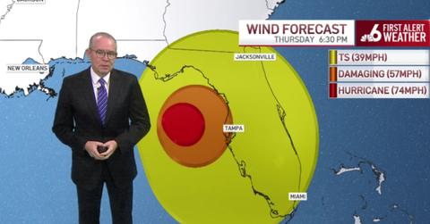
While meteorologists are used to covering major storms and warning people of the dangers they'll face, it's not often that they get rattled by what they're reporting. On Monday, Oct. 7, one veteran South Florida meteorologist was emotional and moved to tears as he tried to explain the scope of what the Yucatan in Mexico and the west coast of Florida is about to face down in a Hurricane Milton update.

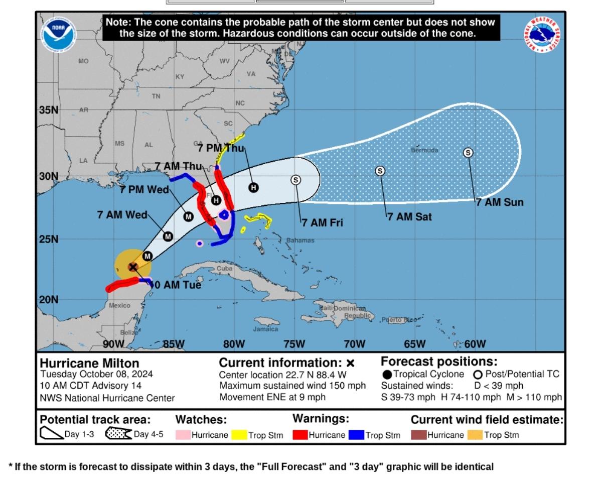
Please note: This graphic is accurate as of 12 p.m. on Oct. 8, 2024. Please seek current information through weather.gov.
Meteorologist gets emotional during Hurricane Milton update.
On Monday, Oct. 7, Hurricane Milton took away the breaths of many seasoned weathermen. Meteorologists, hobby weatherists, and people in the path of the storm were all thrown for a loop as the storm broke several records by rapidly intensifying to a powerful Category 5 hurricane just north of the Yucatan Peninsula, Mexico. Although the wind speeds have slowed somewhat since then, the impact of the moment was powerful for many watching.
John Morales, one of South Florida's most seasoned meteorologists, was emotional and moved to tears while discussing Hurricane Milton on Monda His voice broke as he explained, "It has dropped 50 millibars in 10 hours." He waited for a moment to gather himself and added, "I apologize. This is just horrific." He reported that, at the time, the storm had maximum sustained winds of 160 miles per hour, which later increased before decreasing again.
The concern and upset in his voice was obvious as the experienced meteorologist grappled with the enormity of what the Yucatan and the west coast of Florida could be facing with Milton's ominous approach.
What are millibars and what do they mean for hurricane forecasting?
Meteorology is a science, but one that comes with much uncertainty and many variables. In weather forecasting, they rely on several units of measure to determine a storm's strength. Those units might include wind speeds in miles, kilometers, or knots per hour, and atmospheric pressure measured in something known as millibars.
At sea level, typical air pressure is just above 1000 millibars, usually right around 1013. But when a storm comes, the pressure lowers. The lower the pressure, the stronger the storm. It's one of the most reliable ways of measuring the power of a hurricane, as it's a solid and measurable point against which meteorologists can base their data and predictions on.
For instance, as Hurricane Milton moved towards the Yucatan Peninsula, its pressure dropped to the point that it became the fifth most intense hurricane ever recorded in the Atlantic basin. As its pressure dropped into the high 800s, the wind speed increased accordingly until wind speeds peaked around 180 miles per hour. From there, it underwent what is known as an eye-wall replacement cycle, where the system essentially reset its core and grew in size, slightly lessening in strength.
As it lessened in wind speed and strength, the pressure increased. Now that the eye-wall replacement cycle is complete, the storm has resumed its march toward Florida as a powerful Category 4. While it has plenty of hot water and hot air to feed it in the short term, it is expected to encounter wind shear closer to the Florida Peninsula. Wind shear is an upper-level wind that has the potential to shred a little of the storm's integrity and weaken it some, forcing dry air toward the storm's core.
Because hurricanes thrive on warm, moist air, this has the potential to weaken the storm. However, even if the storm does weaken, it still poses a catastrophic threat to life and property as it barrels toward Florida. The impacts will begin somewhere along the central western Gulf Coast and extend inward toward the east coast. Milton is expected to remain a hurricane as it exits into the Atlantic and brings impacts to Florida.
Whether the storm weakens or strengthens before landfall, it is imperative that those in its path and in surrounding areas follow the recommendations of officials. Please visit weather.gov and follow your local news, weather, and information sources for official news on evacuations, flood zones, wind warnings, storm shelters, and other vital information you need ahead of Milton.
